 Skip to content
Laguna Torre hike
The Laguna Torre Hike follows a scenic trail from El Chaltén to a glacial lake beneath the dramatic granite spires of Cerro Torre. The route passes through native forest, open valleys, panoramic viewpoints, and some of the best photography locations in the area.
Distance: 18 Km ( 11 miles ) | Elevation gain: 250-350 Meters (800- 1150 feet) | Duration: 5-7 hrs | Difficulty: Medium
★★★★★ 5.0 on Google 153 verified traveler reviews


Laguna Torre trail

Distance: 18 Km ( 11 miles ) | Elevation gain: 250-350 Meters (800- 1150 feet) | Duration: 5-7 hrs | Difficulty: Medium
The Laguna Torre trail starts directly in El Chaltén, so no transfers are needed. Your guide will meet you at your hotel and walk with you to the Start of the Laguna Torre Trail.
The hike begins with a gentle climb past the Mirador Margarita waterfall. From there, the trail continues for approximately 2 km through a section of moderate elevation gain and loss before reaching Mirador Cerro Torre. After this viewpoint, the trail becomes flatter and more enjoyable.
From Mirador Cerro Torre, the trail descends for approximately 0.5 km. Near the 3 km marker, it levels out and continues through the valley for around 4 km, offering panoramic views with Cerro Solo, Cerro Grande, Cerro Doblado, Cerro Nato, Adela Sur, Adela Centro and Cerro Torre.
At Laguna Torre, you can enjoy lunch beside the lake while watching icebergs drift beneath Cerro Torre. When the wind is strong, we eat lunch at the Agostini Base Camp inside the Lenga forest.
There is also an optional 45-minute extension to Mirador Maestri, where you can enjoy closer views of Glacier Grande, Laguna Torre, and Cerro Torre. Afterward, the return to El Chaltén follows the same trail and is mostly downhill.
After visiting Laguna Torre or Mirador Maestri, you will follow the same trail back to El Chaltén. The return is mostly downhill, with another opportunity to enjoy the valley, forests, and mountain views along the way. Your guide will accompany you back to your hotel.
Short on time? Laguna Capri is a separate, shorter walk on the Fitz Roy trail. Browse the full list of El Chaltén hikes with a local guide.
Laguna Torre Trail - Common Questions
How long is the Laguna Torre trail?
The Laguna Torre Trail is 18 Km ( 11 miles ). If you hike out to Mirador Maestri it’s a 22KM round trip hike.
Has anyone climbed Cerro Torre?
Yes, many people have climbed Cerro Torre since the first undisputed team climbed it January 13th, 1974. Roughly, 2-20 people climb it per year.
Where is Cerro Torre?
Cerro Torre is located in Southern Patagonia, on the border between Argentina and Chile. It rises within the Southern Patagonian Ice Field, about 15 kilometers west of El Chaltén, Argentina, and is part of the Cerro Torre mountain group near Los Glaciares National Park.
What to wear hiking in Patagonia?
Short answer: Dress in layers, prioritize wind/rain protection, and avoid cotton.
Core layers
Base layer: Synthetic or merino top (long/short sleeve depending on temp).
Mid layer: Fleece or light insulated jacket (synthetic or down).
Shell: Waterproof/windproof jacket (2.5–3L; taped seams, good hood); lightweight rain pants.
Bottoms: Quick-dry hiking pants or leggings; add thermal tights in cold/windy conditions.
Footwear
Shoes/boots: Sturdy, broken-in hikers with good tread (wet roots/rock).
Socks: Merino or synthetic; consider liner socks to prevent blisters.
Optional: Gaiters for mud/snow; microspikes in winter/early spring if icy.
Accessories (don’t skip)
Brimmed cap + warm hat (wind steals heat fast).
Gloves (light liner + wind/waterproof shell if cold).
Sunglasses (category 3–4 if near snow/ice); high-SPF sunscreen & lip balm.
Buff/neck gaiter for wind and sun.
Trekking poles (windy descents), small first-aid, space blanket.
Seasonal tweaks (Southern Hemisphere)
Summer (Dec–Feb): Light base, breathable mid, full shell for wind; sun gear is critical.
Autumn (Mar–May): Warmer mid layer; pack thin insulated pants/gloves.
Winter (Jun–Aug): Heavy mid + insulated jacket; thermal base on legs; microspikes/gaiters.
Spring (Sep–Nov): Unstable—bring full rain kit and warm layers even on “nice” days.
Key tips
Layer early: Add/remove before you sweat or chill.
Waterproof ≠ breathable: Vent (pit zips, front zip) during climbs.
No cotton: Stays wet, increases chill risk.
I will document your adventure in El Chaltén.
Every moment in Patagonia is a masterpiece waiting to be captured. With our professional photography services, you can relive this magical place in the world, and your incredible journey for years to come. Let us turn your adventure into a story you’ll cherish forever.

Hire a Porter
Carry less, hike farther, and enjoy the trail with reliable porter support in El Chaltén.
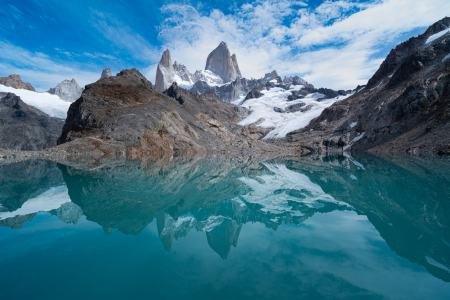
Laguna de los Tres
Discover Laguna de los Tres, one of the most popular hikes in El Chaltén, with unforgettable views of Mount Fitz Roy.