 Skip to content

El Chaltén Hikes
Find your hike beneath Fitz Roy and Cerro Torre. Compare trails by difficulty, walking time and transport, then plan a guided day or ask to join a hiking group.
Which El Chaltén hike is right for you?
El Chaltén is a hiking base in Patagonia, with routes leading toward Mount Fitz Roy, Cerro Torre and the northern mountains of Los Glaciares National Park. The right hike depends on your available time, experience and the conditions on the day.
Distances and times are approximate return-route estimates. Weather, pace, trail conditions and optional extensions affect the day; road and boat travel are additional unless stated. Check the El Chaltén weather forecast before choosing your route.
Explore the El Chaltén hiking map
Choose a route to see its published track. Open a hike guide for the full description, or return to its card to compare your options.
Load the map to explore. Pan and pinch zoom stay locked until you enable them, so you can keep scrolling the page.
Laguna de los Tres
Explore the route from El Chaltén, then read our Laguna de los Tres trail guide.
Use this map to plan your trip, and check current access and trail conditions before heading out. Some routes include extensions beyond the destination. Huella de Glaciares includes road and boat connections. Marked camps and services do not confirm current availability.
The Vespignani viewpoint is marked, but its hiking route is not drawn. See the Vespignani boat excursion and hike guide for trip planning.
Llao Llao 95, Z9301XAF El Chaltén, Santa Cruz
Open in Google Maps ↗ · Message Connect PatagoniaThe three classic hikes in El Chaltén
Laguna de los Tres is the classic Fitz Roy hike. Laguna Torre follows a gentler valley toward Cerro Torre. Loma del Pliegue Tumbado offers a wider panorama with more elevation gain.

Laguna de los Tres
Choose this hike for a close view of the Fitz Roy massif. The final kilometre climbs roughly 400 metres over steep, rocky terrain, making it the main challenge of the day.
- Round trip
- 22.5 km
- Typical time
- 7–9 hours
- Difficulty
- Hard
- Elevation gain
- 900–1,050 m
Main view: Mount Fitz Roy and Laguna de los Tres
Getting to the trailWalk from town. A transfer is needed if you choose the alternative Río Eléctrico start.
Save it for a suitable weather window and allow for the descent.

Laguna Torre
A long valley walk with a gentler elevation profile than Laguna de los Tres. It is a useful comparison if you are comfortable with distance but prefer less steep climbing.
- Round trip
- 18 km
- Typical time
- 5–7 hours
- Difficulty
- Moderate
- Elevation gain
- 250–350 m
Main view: Cerro Torre, Laguna Torre and the Adela Range
Getting to the trailNo transfer required. The trail starts in El Chaltén.
Allow extra time for any extension beyond the lagoon, including Mirador Maestri.

Loma del Pliegue Tumbado
A sustained climb for a broad panorama of the Fitz Roy and Cerro Torre massifs. It gains more elevation than Laguna de los Tres and finishes on exposed upper terrain.
- Round trip
- 20 km
- Typical time
- 7–8 hours
- Difficulty
- Hard
- Elevation gain
- 1,100 m
Main view: Fitz Roy, Cerro Torre, Laguna Torre and the surrounding valleys
Getting to the trailNo transfer required. Start near the park ranger station at the entrance to town.
Wind matters on the upper route. The highest viewpoint may not be appropriate in the conditions.
Choosing a demanding full day? Laguna de los Tres concentrates its main challenge in the steep final climb. Loma del Pliegue Tumbado involves a longer, exposed ascent. Consider porter support for a heavy backpack and hiking equipment rental as part of your preparation.
Shorter hikes & viewpoints from town
Mirador de los Cóndores and Chorrillo del Salto offer lower-effort outings. Laguna Capri takes longer and includes a sustained initial climb. Short routes still need a weather and conditions check.
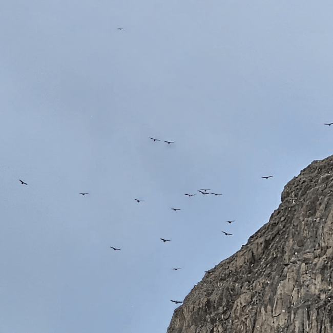
Mirador de los Cóndores & Águilas
Short walks with views over El Chaltén and the surrounding landscape. Visit Mirador de los Cóndores on its own or combine it with the Águilas viewpoint.
- Round trip
- About 2–4 km
- Typical time
- 1–2 hours
- Difficulty
- Easy
- Main view
- Fitz Roy skyline, Lago Viedma and the steppe
Getting to the trailNo transfer required. Walk to the ranger station at the entrance to town.
Distance depends on whether you visit one viewpoint or both.

Chorrillo del Salto
A lower-effort option for a shorter outing, following native forest to the waterfall. Starting near the parking area shortens the walking distance considerably.
- Round trip
- About 1–6 km
- Typical time
- 1–3 hours
- Difficulty
- Easy
- Main view
- Chorrillo del Salto waterfall and lenga forest
Getting to the trailWalk from town or take a short transfer to the parking area.
About 6 km return from town, or about 1 km return from the parking area.

Laguna Capri
A shorter alternative to Laguna de los Tres, with an initial climb followed by forest and lakeside views. Compare this route when you want a half-day hike rather than a full mountain day.
- Round trip
- 8 km
- Typical time
- 3–5 hours
- Difficulty
- Moderate
- Elevation gain
- 400 m
Main view: Laguna Capri and the Fitz Roy massif
Getting to the trailNo transfer required. Use the Fitz Roy trail at the northern end of town.
Shorter does not mean flat: most of the climbing comes early.
Lakes, glaciers & the Río Eléctrico valley
These outings start beyond El Chaltén. Plan the transfer as well as the hike, and confirm boat arrangements if you choose Vespignani Glacier.

Laguna Huemul
A short hike near Lago del Desierto, with a glacial lake and views of Huemul Glacier. It can form part of a day in the Lago del Desierto area.
- Round trip
- About 2 km
- Typical time
- 1–2 hours
- Difficulty
- Easy
- Main view
- Laguna Huemul and Huemul Glacier
Getting to the trailA road transfer to Lago del Desierto is required from El Chaltén.
Allow separately for the road journey and check access arrangements before you go.

Vespignani Glacier
Combine a boat excursion with a choice of glacier-view trails. The lower viewpoint is a shorter walk; the upper route involves more climbing.
- Round trip
- About 2–4 km
- Typical time
- Up to 2–3 hours hiking
- Difficulty
- Easy to moderate
- Main view
- Vespignani Glacier and Lago del Desierto
Getting to the trailA road transfer to Lago del Desierto and a scheduled boat are required.
Hiking time varies by trail. Road and boat travel are additional; confirm the excursion schedule.

Piedra del Fraile
Follow the Río Eléctrico valley through forest toward the Piedra del Fraile camping and refugio area. This is a sustained day of walking with a more gradual ascent.
- Round trip
- About 16 km
- Typical time
- 6–8 hours
- Difficulty
- Moderate
- Main view
- Río Eléctrico valley and the surrounding mountains
Getting to the trailA transfer to Puente del Río Eléctrico is required from El Chaltén.
The return estimate does not include onward routes such as Paso del Cuadrado.
Plan the rest of your hiking day
Choose the route first, then make the weather, equipment and support work around it.
Choose your weather window
Read the wind, gusts, cloud and precipitation forecasts for town and the higher trails. Conditions can differ along the route.
Check El Chaltén weather →Pack for changing conditions
Plan layers, rain protection and the equipment your route needs. Explore rental options before you arrive.
Explore gear rental in El Chaltén →Get help with the load
Planning a long day or carrying a heavy backpack? Discuss porter support for your route and group.
Arrange porter support in El Chaltén →Make room for photographs
If photographs are a priority, discuss a hiking photography session and how it fits your route and pace.
Explore hiking photography in El Chaltén →Turn your shortlist into a hiking plan
Choose a hike
Compare the route cards and open the full trail guide. Use “Copy hike link” to send the same guide to your friends.
Share your plans
Tell us your dates, party size, experience and preferred hike. If you want company, send a request through our join a hiking group page.
Confirm the details
We discuss a suitable option and the arrangements with you. A group request is not a confirmed booking and does not guarantee that a group will form.
Unsure which route fits your trip?
Share your dates and experience with Connect Patagonia. We can help you compare the options and discuss a guided hike.
El Chaltén hiking questions
What is the best hike in El Chaltén?
If your priority is Mount Fitz Roy and you are prepared for a demanding day, Laguna de los Tres is the classic choice. Laguna Torre has a gentler elevation profile, while Loma del Pliegue Tumbado offers a broader panorama. Match the route to your fitness and the forecast.
What are the must-do hikes in El Chaltén?
The three classic routes are Laguna de los Tres, Laguna Torre and Loma del Pliegue Tumbado. They offer different views of the Fitz Roy and Cerro Torre massifs. Decide how many to attempt based on your available days, recovery time and conditions.
Should I hire a guide in El Chaltén?
A guide can help with route decisions, navigation and interpreting conditions. Discuss a guided hike if you are uncertain about your ability, planning a demanding route or hiking with a group whose experience varies. Ask us about a guided hike with your dates and preferred trail.
What should I wear hiking in El Chaltén?
Plan layers: a moisture-wicking base layer, a warm insulating layer, weather-resistant hiking trousers and a waterproof outer layer. Bring equipment suited to your route and check the conditions before leaving. Our El Chaltén gear rental page can help with equipment you need for the trip.
How many days should I spend in El Chaltén?
Around five days gives you more room to spread out the classic hikes, rest and adjust your plans than a short visit. It does not guarantee clear weather. Keep your itinerary flexible and check the local hiking weather forecasts as your dates approach.
Can I hike in El Chaltén without a car?
Yes. The classic hikes, Laguna Capri and the Cóndores viewpoints are accessible on foot from town. Your walk to the trailhead depends on where you stay. Lago del Desierto outings and Piedra del Fraile need transport to their starting areas; Vespignani Glacier also requires a boat.
Can I hire a porter for a hike?
Yes. Connect Patagonia offers porter support in El Chaltén to help carry heavy backpacks. Discuss your route, dates and what you need carried so the arrangements match your hike.
How can I share a hike with my friends?
Each route card has a “Copy hike link” button that copies its full Connect Patagonia trail guide URL. Paste it into WhatsApp, a message or email. Where your browser supports it, “Share with friends” opens your device’s sharing options.
Find the hike that fits your trip
Choose your trail, compare the conditions and tell us what you have in mind. We will help you plan the next step.